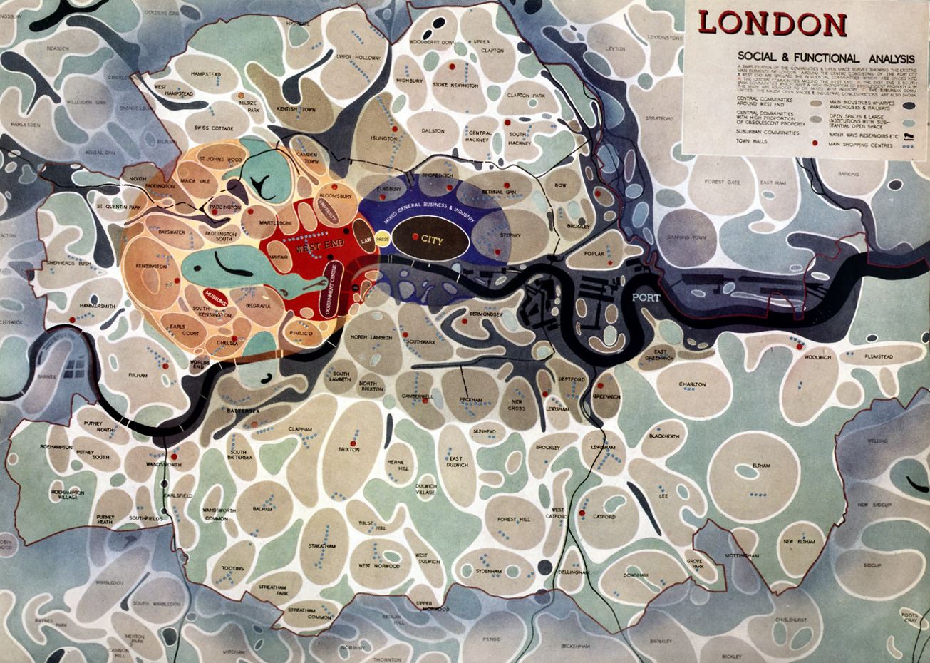
1.1. miradas | WAYS OF SEEING
Creada el 21 de Septiembre de 2026 a las 14:26 por abarcaProyecto: Urbanismo 1_2026 / Urban Design 1_2026
Tema: 1.1. miradas | WAYS OF SEEING
Coordinadores:
abarca
falvarez
Valoración general
0/5 (0 votaciones)Valoración de coordinadores
0/5 (0 votaciones)Descripción
EntradaBlog
Entrada de Blog
1.1. miradas | WAYS OF SEEING
ES - ESPAÑOL
Ejercicio 1. Ciudad y sus miradas
Cartografiar lo visible para descubrir lo latente
El ejercicio consiste en construir cartografías interpretativas de la ciudad asignada. Podrá abarcar la ciudad completa o una parte especialmente relevante. La elección del ámbito, la escala y el encuadre —el marco de la cartografía— constituye una de las decisiones fundamentales del trabajo y deberá permitir comprender las relaciones que explican la forma urbana.
La cartografía estudiará las singularidades del soporte geográfico y las maneras en que la ciudad se adapta al sitio, lo aprovecha o lo transforma. Se atenderá a accidentes y nuevos órdenes, orientación, pendientes, rasantes, cursos de agua, pequeñas elevaciones, visuales y otros lugares o detalles del relieve urbano. Cuando se seleccione una parte de la ciudad, deberá comprenderse su encaje en la situación geográfica y urbana general.
El ejercicio no consiste en dibujar únicamente curvas de nivel y contornos de manzanas. En una única representación deberán integrarse, según su importancia en cada caso, sin ser excluyente:
-La geografía y sus transformaciones.
-Las grandes infraestructuras y sus efectos como conexiones o barreras.
-La estructura urbana básica.
-Las partes o fragmentos de la ciudad.
-Las formas urbanas fundamentales: calles, plazas, parques y arquitecturas singulares.
-Las relaciones, procesos o fuerzas no directamente visibles.
-Cualquier otro aspecto que resulte relevante.
No todos estos temas tendrán el mismo peso. Su selección, jerarquía y alcance gráfico deberán responder a su capacidad para explicar la singularidad del ámbito estudiado.
Siguiendo a James Corner (2011), la cartografía incorporará de manera integrada al menos dos enfoques de los siguientes: deriva, superposición, tablero de juego o rizoma. Los mapas deberán combinar correspondencias reconocibles con el territorio y formas abstractas de representar conexiones, conflictos, intensidades o procesos latentes.
Se recomienda especialmente el dibujo exploratorio realizado principalmente de forma manual, entendido como una herramienta para observar, pensar, seleccionar y descubrir. Las fuentes digitales, históricas o fotográficas podrán utilizarse como documentación, pero deberán ser interpretadas y reelaboradas mediante el dibujo.
Se entregarán exclusivamente cartografías integradas, con una escala que resulte adecuada para el marco seleccionado. Se valorará la pertinencia del encuadre, la comprensión de la relación entre ciudad y soporte geográfico, relaciones entre el campo, periferia y ciudad, así como la integración y jerarquización de las temáticas elegidas, la claridad del lenguaje gráfico y la capacidad de la cartografía para revelar relaciones no evidentes.
EN - ENGLISH
Exercise 1. The City and Ways of Seeing It
Mapping the Visible to Reveal the Latent
This exercise consists of producing interpretive maps of the assigned city. The maps may cover the entire city or a particularly significant part of it. Choosing the study area, scale and framing—the extent of the map—is one of the fundamental decisions in the exercise. These choices should make it possible to understand the relationships that shape urban form.
The mapping will examine the distinctive features of the geographical setting and the ways in which the city adapts to, takes advantage of or transforms its site. Attention should be paid to landforms and new spatial orders, orientation, slopes, street levels, watercourses, small elevations, views, and other places or details of the urban terrain. If a part of the city is selected, its place within the city’s broader geographical and urban setting must be understood.
The exercise is not simply a matter of drawing contour lines and block outlines. A single representation should integrate the following themes according to their importance in each case; the list is not exhaustive:
Geography and its transformations.
Major infrastructure and its effects as connections or barriers.
The basic urban structure.
The city’s constituent areas or fragments.
Fundamental urban forms: streets, squares, parks and distinctive buildings.
Relationships, processes or forces that are not directly visible.
Any other relevant aspect.
These themes need not receive equal emphasis. Their selection, relative importance and graphic treatment should reflect their ability to explain what makes the study area distinctive.
Following James Corner (2011), the mapping should integrate at least two of the following approaches: drift, layering, game-board or rhizome. The maps should combine recognisable relationships to the territory with abstract ways of representing connections, conflicts, intensities or latent processes.
Exploratory drawing, carried out primarily by hand, is especially encouraged as a tool for observing, thinking, selecting and discovering. You may use digital, historical, and photographic sources as reference material, but you should interpret and rework them through drawing.
Submissions must consist exclusively of integrated maps at a scale appropriate to the selected area. Assessment will consider the relevance of the chosen framing; the understanding of the relationship between the city and its geographical setting, and between countryside, periphery and city; the integration and prioritisation of the selected themes; the clarity of the graphic language; and the maps’ ability to reveal relationships that are not immediately apparent.
Referencia | References:
Corner, J. (2011) The Agency of Mapping: Speculation, Critique and Invention. In “The Map Reader: Theories of Mapping Practice and Cartographic Representation”. Ed. Martin Dodge, Rob Kitchin and Chris Perkins.
Algunos ejemplos | Some examples:
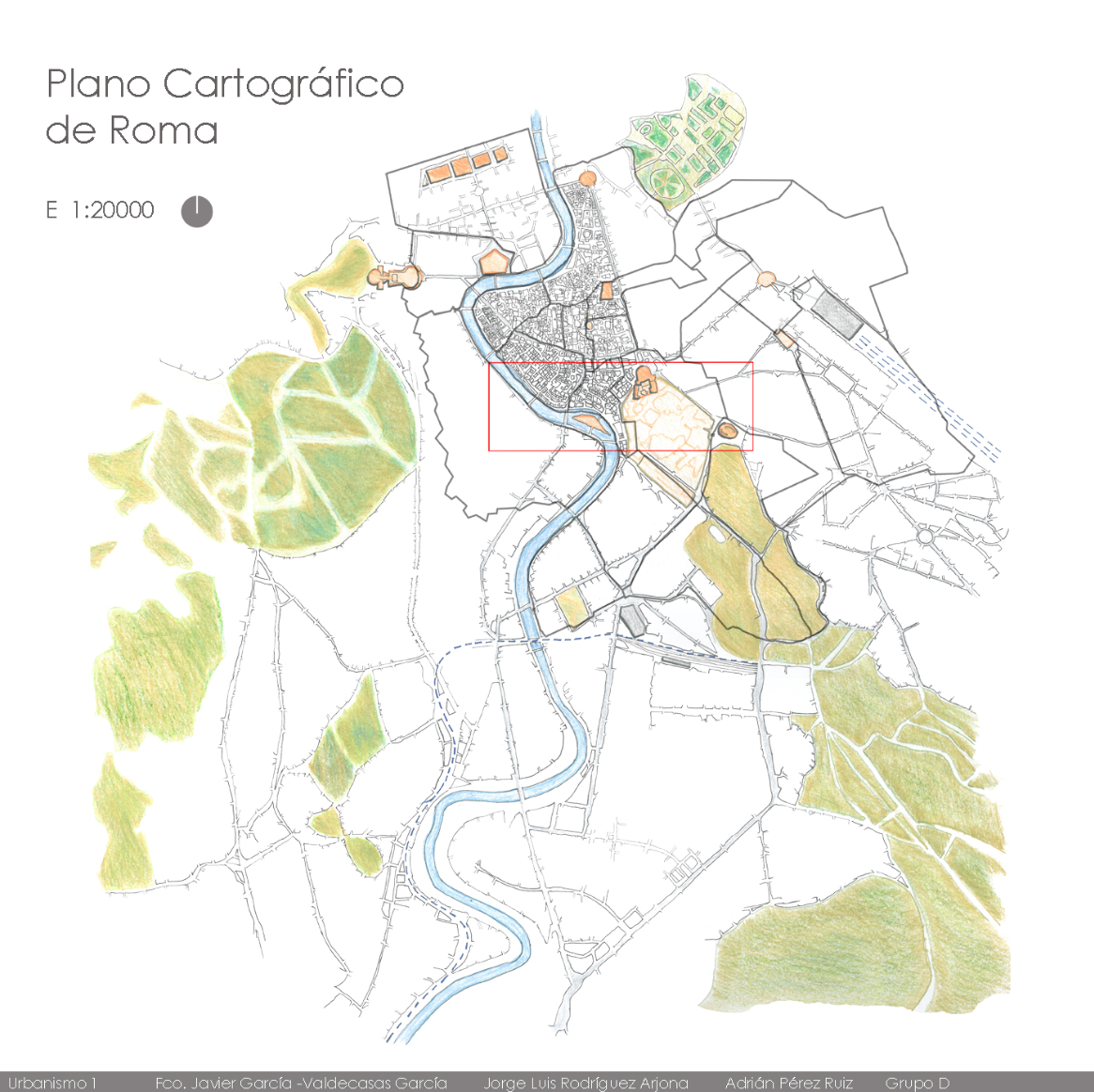
Roma by xavii.gilabert - CarlaBarba - Jmiquel . Source: http://www.doyoucity.com/es/proyectos/entrada/24368
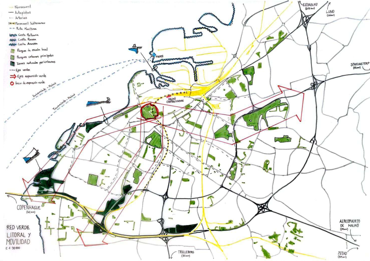
London by adripr11 - jorgerodar - franchogvg. Source: http://www.doyoucity.com/es/proyectos/entrada/2805
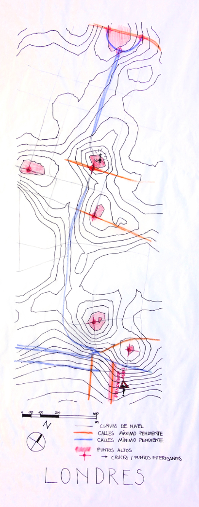
Source: http://www.doyoucity.com/es/proyectos/entrada/8056 by lenajaeger
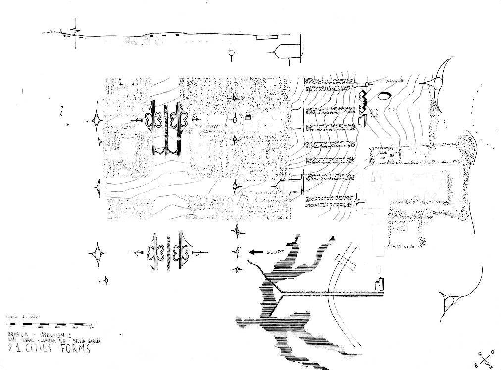
Brasilia by silviagv - Claudiagarcia23 - gaelferracci. Source: http://www.doyoucity.com/es/proyectos/entrada/23569
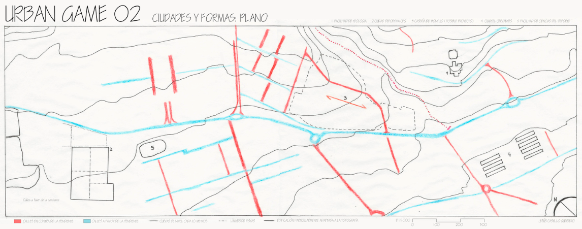
Granada by jesuscastilloguerrero. Source: http://www.doyoucity.com/es/proyectos/entrada/18586
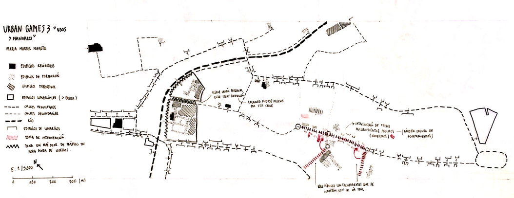
Granada by mariamm. Source: http://www.doyoucity.com/es/proyectos/entrada/18608
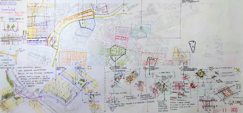
Granada by FranciscoJavierGarciaMontero. Source: http://www.doyoucity.com/es/proyectos/entrada/18898
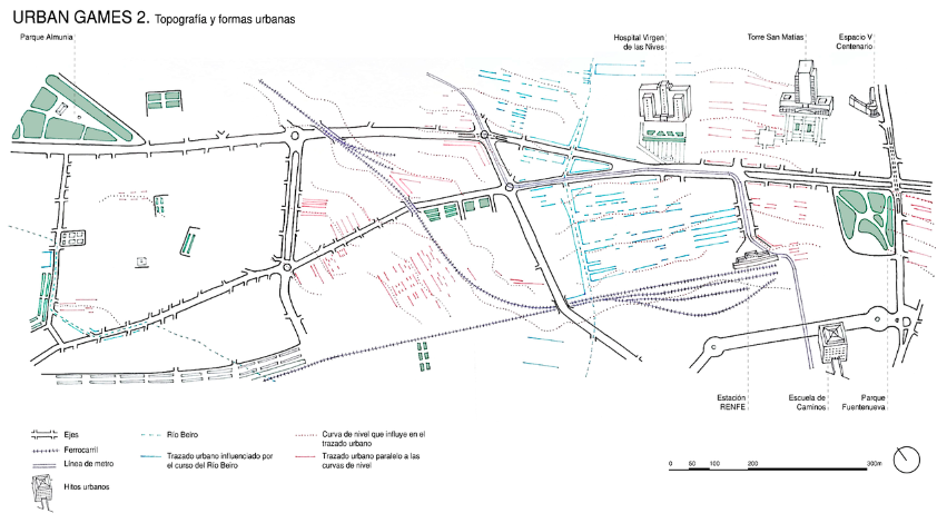
Granada by DGL. Source: http://www.doyoucity.com/es/proyectos/entrada/19097
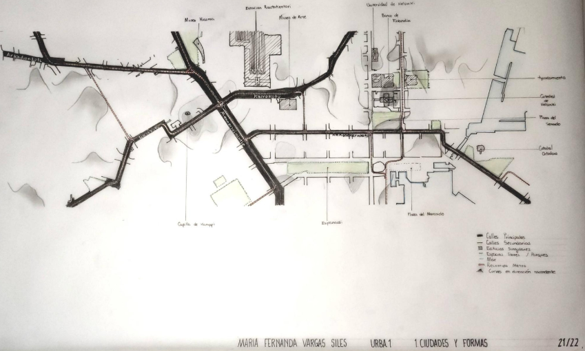
Helsinki by MariaFV. Source: http://www.doyoucity.com/es/proyectos/entrada/19461
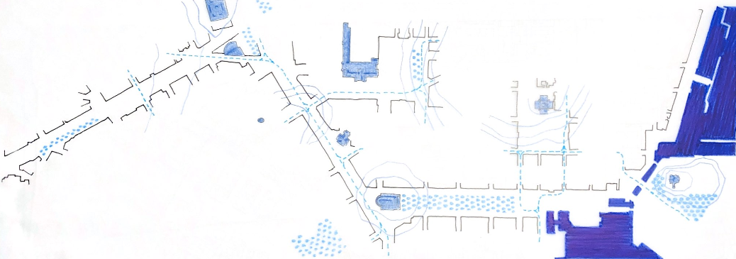
Helsinki by AlvaroBV. Source: http://www.doyoucity.com/es/proyectos/entrada/19577

Helsinki by marinaclemente. Source: http://www.doyoucity.com/es/proyectos/entrada/19518
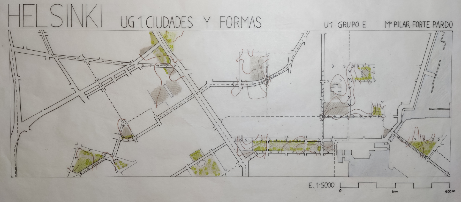
Helsinki by Fortemp. Source: http://www.doyoucity.com/es/proyectos/entrada/19488
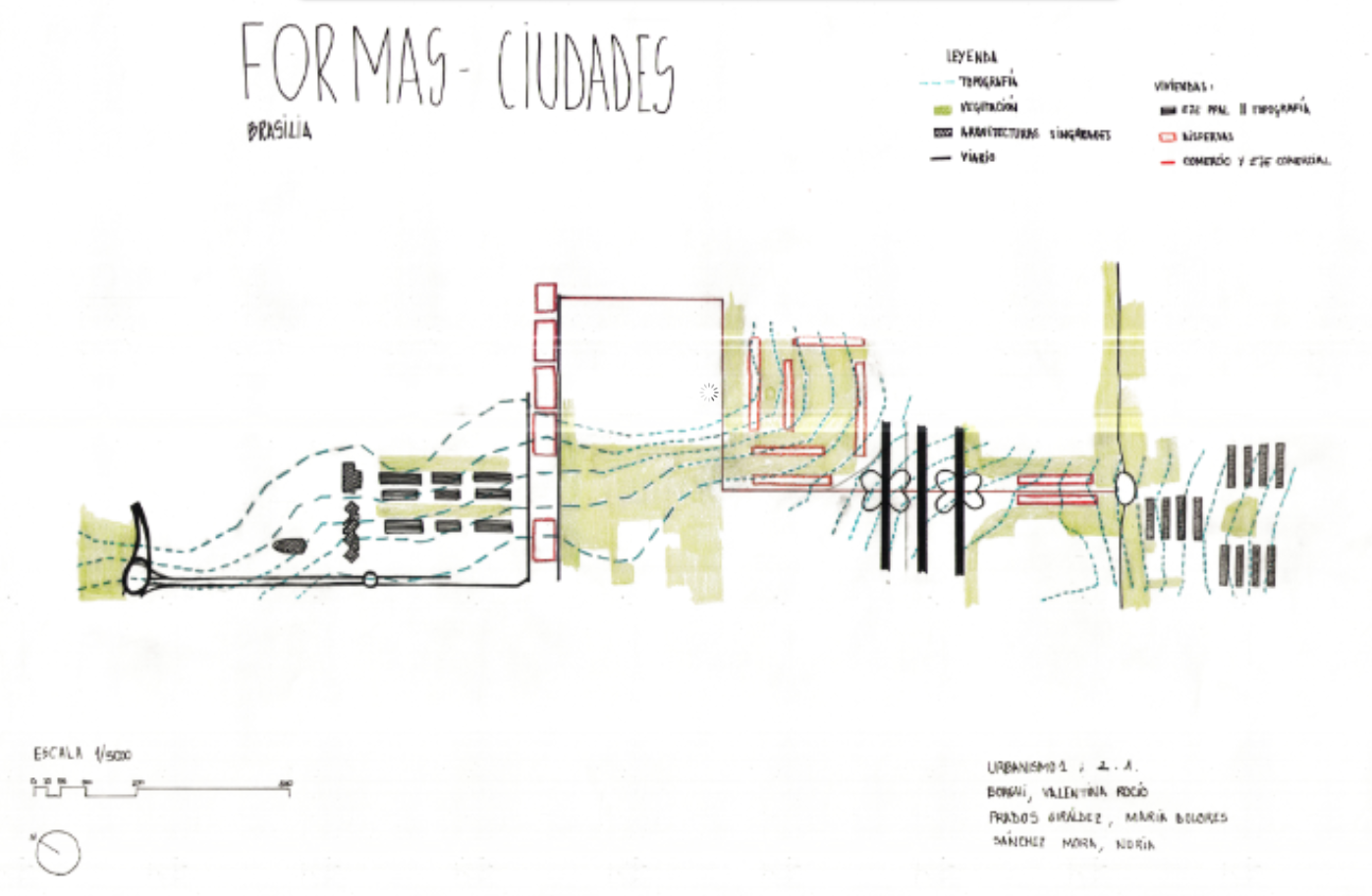
Brasilia by valenborghi - Lolamaria - nuriasanchez. Source: http://www.doyoucity.com/es/proyectos/entrada/23324
Comentarios
Aún no hay comentarios para esta entrada. ¡Sé el primero!
Accede o regístrate para comentar y puntuar la entrada.